

Short Answer
Location
Cape Fligely lies on the northern tip of Rudolf Island, the most northerly island of the Franz Josef Land archipelago in the Arctic Ocean. Its precise coordinates are 81°50′35″ N 59°14′22″ E, placing it 909 km (565 mi) south of the geographic North Pole and making it the furthest north point of the Eurasian landmass.1
Map
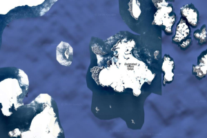
The cape is situated at the extreme northern edge of the archipelago, which itself stretches roughly 400 km east‑west across the high Arctic. On most modern nautical charts the cape is marked as a prominent black‑white contrast of ice‑cliff and sea ice, serving as a reference point for vessels navigating the marginal ice zone.
Geography
Franz Josef Land comprises about 191 islands spread over an area of roughly 16,100 km². The islands are grouped into several clusters – the western Alexandra Land, the central Zemlya Georga, and the eastern Graham Bell Island – all underlain by a rugged, glaciated landscape. The terrain is dominated by ice caps, steep sea‑cliffs, and low‑lying tundra valleys. The average elevation is modest, with the highest point, approximately 620 m, located on Zemlya Georga.1
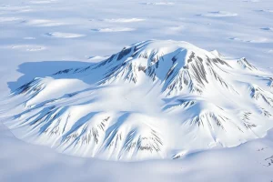
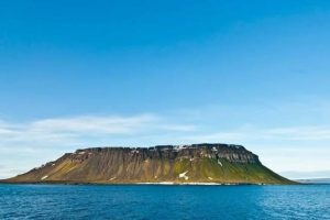
Rudolf Island, home to Cape Fligely, is relatively small (≈2 500 km²) but steeply rising; its northern cliffs plunge directly into the Arctic Ocean, creating a dramatic, ice‑bound coast that is often visible from satellite imagery.
Glaciers
The archipelago is almost entirely covered by glaciers and ice caps. The largest individual glaciers include:
| Glacier | Island | Approx. Area (km²) | Notes |
|---|---|---|---|
| Rudolf Ice Cap | Rudolf Island | ≈1 200 | Feeds ice cliffs that terminate at Cape Fligely. |
| Hall Glacier | Hall Island | ≈900 | Flows eastward into the Barents Sea. |
| Graham Bell Ice Cap | Graham Bell Island | ≈1 500 | One of the most studied ice masses in the archipelago. |
| Zemlya Georga Ice Dome | Zemlya Georga | ≈1 800 | Contains the highest point of the archipelago. |
Glacial melt and calving are monitored annually by Russian and international research programs, providing valuable data on Arctic climate change.
Geology
Franz Josef Land rests on a Precambrian shield of Archean rocks, overlain in places by Paleozoic sedimentary layers. The islands are primarily composed of metamorphic gneisses and schists, intruded by late‑Cretaceous granitic dykes. The rugged topography reflects a long history of glacial erosion, with U‑shaped valleys and cirques carved into the bedrock. Permafrost underlies the thin tundra soil, reaching depths of several hundred meters in interior valleys.
Wildlife
Despite the extreme latitude, the archipelago supports a surprisingly diverse Arctic ecosystem. Key species include:
- Polar bears – often seen on sea‑ice floes hunting seals near the coast of Cape Fligely.
- Ringed seals – haul out on ice floes and in coastal bays.
- Walruses – use the shallow waters of the northeastern islands for breeding.
- Arctic foxes – inhabit the tundra zones, feeding on bird eggs and carrion.
- Seabirds – such as ivory gulls and black‑legged kittiwakes, nest on cliffs and ice‑free ledges.
Vegetation is limited to mosses, lichens, and low‑lying dwarf shrubs, forming a sparse tundra that blooms briefly during the Arctic summer.
Exploration History
The first recorded European sighting of Franz Josef Land occurred in 1873 during the Austro‑Hungarian North‑Pole expedition led by Julius von Payer and Karl Weyprecht. On 12 April 1874 the party reached the northern tip of Rudolf Island and named the promontory after the Austrian cartographer Field Marshal August von Fligely (1811‑1879). This act established Cape Fligely as a reference point for subsequent polar voyages.1
“We stood upon the most northern point of the European continent, a silent witness to the endless ice that surrounds us.” – Julius von Payer, 1874
Later Russian Imperial and Soviet expeditions used the cape as a navigation aid. In the 1930s, the Soviet Arctic Institute established a temporary weather station on nearby Hall Island, underscoring the strategic importance of the region.
Historic Sites
No permanent settlements exist on Cape Fligely, but the archipelago hosts several historic remnants:
- Baranov Research Station – a Soviet‑era outpost on Hall Island, now abandoned but still visible as rusted metal structures.
- Mys Shmidta – a former polar station on Graham Bell Island, used for meteorological observations during the Cold War.
- Explorers’ cairns – stone piles erected by 19th‑century Austrian and later Russian parties as markers of their routes.
These sites are protected under Russian heritage law and are occasionally visited by scientific teams.
Scientific Research
Modern research on Franz Josef Land focuses on glaciology, climate monitoring, and Arctic ecology. Russian Arctic and Antarctic Research Institute (AARI) maintains seasonal field campaigns that collect ice‑core samples, GPS measurements of glacier flow, and atmospheric data. International collaborations, such as the International Arctic Science Committee (IASC), use the islands as reference points for satellite calibration and sea‑ice modelling.
Key research topics include:
- Ice‑cap mass balance and contribution to sea‑level rise.
- Permafrost dynamics and carbon release.
- Polar bear population genetics and migration routes.
- Atmospheric chemistry in the high Arctic, including ozone depletion studies.
Name Origin
The cape was named by the Austro‑Hungarian North‑Pole expedition after August von Fligely, a distinguished Austrian cartographer and field marshal who modernised the empire’s military mapping system in the mid‑19th century. Fligely’s contributions to topographic surveying made the naming a fitting tribute to his legacy.1
Related Islands
While Cape Fligely belongs to Rudolf Island, the broader Franz Josef Land archipelago includes several other notable islands:
- Hall Island – south of Rudolf, site of the abandoned Baranov station.
- Graham Bell Island – the largest island, home to the former Mys Shmidta station.
- Zemlya Georga (George Land) – central island with the archipelago’s highest elevation.
- Alexandra Land – western sector, featuring rugged cliffs and seasonal seabird colonies.
- Zichy Island – a smaller island east of Graham Bell, known for its exposed bedrock outcrops.
Each island contributes to the complex mosaic of Arctic habitats, geological formations, and research opportunities that define Franz Josef Land.
FAQ
Is Cape Fligely the northernmost point of Europe?
Yes. Cape Fligely is recognised as the northernmost point of Europe, as well as the northernmost point of the Eurasian continent.
Which expedition first sighted Cape Fligely?
The Austro‑Hungarian North‑Pole expedition of 1873‑74, led by Julius von Payer and Karl Weyprecht, first visited the cape on 12 April 1874.
Are there any permanent research stations on Rudolf Island?
No permanent stations exist on Rudolf Island; the nearest seasonal facilities are on Hall Island (Baranov) and Graham Bell Island (Mys Shmidta).


Leave a Reply