
Short Answer
Location
Prince George Land, known in Russian as Zemlya Georga (Земля Георга), lies in the Arctic Ocean at 80°26′43″N 49°00′45″E. It is part of the Franz Josef Land archipelago, administered by Arkhangelsk Oblast, Russia. The island sits west of Alexandra Land and east of Bruce Island, separated by the Proliv Arkhangelskiy and Nightingale Channel respectively.
Map
The island stretches 115 km from north to south, making it the longest island in the group. Its coastline is deeply indented with bays and capes, notably Cape Neale, Cape Crowther, and Cape Grant on the southern shore, and Mys Murray on the eastern extremity.
Geography
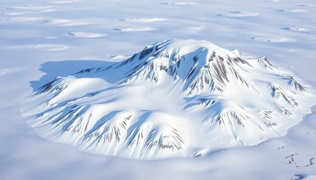
Covering 2,821 km² (1,089 sq mi), Prince George Land is slightly larger than Luxembourg. The terrain is dominated by a series of ice domes, the highest being the Brus Brusilov Ice Dome at 416 m (1,365 ft) above sea level. A largely unglacierized peninsula, Poluostrov Armitidzh, projects from the island’s northern end, offering the only substantial ice‑free land area.
The island’s coastline features a series of prominent capes and inlets: Cape Neale marks the westernmost point, while Mys Bryusa and Mys Battenberg frame Sommerville Bay to the north. The Cambridge Channel (Proliv Kambritch) lies to the southwest, providing a navigable passage between Prince George Land and neighboring islands.
Glaciers
More than three‑quarters of the island is covered by permanent ice. The principal glacial formations are ice domes, each named after early explorers or Soviet research institutions. The most notable include:
| Ice Dome | Location | Notes |
|---|---|---|
| Brusilov Ice Dome | North‑east | Highest point, 416 m |
| Gretton Ice Dome | Central | Broad, gently sloping |
| Dzegudze Ice Dome | South‑west | Named after Georgian geographer |
| Zander Ice Dome | South‑central | Prominent crevassed area |
| Foggy Ice Dome | North‑west | Often shrouded in low‑level clouds |
| Arctic Geology Research Institute Ice Dome | East | Site of early Soviet field camps |
| Peary Ice Dome | South‑east | Named for explorer Robert Peary |
These ice domes feed numerous outlet glaciers that descend to the sea, forming ice cliffs along the coast and contributing to the archipelago’s extensive sea‑ice regime.
Geology
The bedrock of Prince George Land consists mainly of Precambrian gneisses and granulites, typical of the Arctic Platform. Overlying these ancient formations are thick sequences of Pleistocene glacial till and moraines deposited during successive glaciations. The island’s geology has been studied through limited fieldwork and remote sensing, revealing a complex interplay between tectonic uplift and glacial erosion.
Wildlife
Although the island is largely ice‑covered, its coastal zones and the ice‑free northern peninsula support Arctic fauna. Polar bears (Ursus maritimus) are the apex predators, using the sea‑ice platform for hunting seals. Ringed seals (Pusa hispida) and bearded seals (Erignathus barbatus) haul out on ice floes and the few rocky beaches. The surrounding waters host occasional visits by bowhead whales (Balaena mysticetus) and narwhals (Monodon monoceros). Seabird colonies, primarily comprised of Atlantic puffins and thick‑billed murres, nest on the cliffs of Cape Neale and Mys Murray during the brief summer.
Exploration History
British explorer Benjamin Leigh Smith first sighted the land in 1880 during his Arctic voyages. Subsequent mapping by Frederick George Jackson’s 1897–1899 expedition confirmed that the previously recorded “Leigh Smith Land” comprised two distinct islands, the larger being today’s Prince George Land and the smaller Alexandra Land. Jackson named the island after Prince George, the future King George V of the United Kingdom.
Historic Sites
Remnants of early 20th‑century Soviet field camps are scattered across the ice domes, particularly near the Arctic Geology Research Institute Ice Dome. These sites include abandoned prefabricated huts, fuel drums, and scientific instruments, offering a tangible link to the era of intensive polar research during the Cold War. No permanent settlements exist, but a seasonal research station, capable of sheltering up to ten personnel, operates during the brief Arctic summer.
Scientific Research
Modern scientific activity focuses on glaciology, climate monitoring, and biodiversity assessments. The seasonal station conducts ice‑core drilling on the Brusilov Dome to reconstruct past atmospheric composition, while satellite‑aided surveys map ice‑flow dynamics across the domes. Biological teams monitor polar‑bear movements via GPS collars and document seabird breeding success, contributing to broader Arctic ecosystem models.
Name Origin
The name “Prince George Land” (Zemlya Georga) was bestowed by Frederick George Jackson in honor of Prince George, the third son of Queen Victoria, who later ascended the British throne as King George V. The Russian name is a direct transliteration of the English designation.
Related Islands
Prince George Land is part of a larger network of islands within Franz Josef Land, each with distinct characteristics:
- Alexandra Land – Lies west of Prince George Land, separated by the Proliv Arkhangelskiy; known for its rugged cliffs and historic polar stations.
- Hall Island – A smaller island north‑east of Prince George Land, notable for its steep basaltic outcrops.
- Bruce Island – Situated east of Prince George Land, divided by the Nightingale Channel; hosts a modest breeding colony of gulls.
- David Island (Ostrovok Davida) – A tiny islet off the southwestern tip, at 80.15 N 47.33 E, often ice‑bound.
FAQ
Why is Prince George Land mostly covered by ice?
The island lies above 80° N latitude, within the high Arctic climate zone where mean annual temperatures remain well below freezing. Persistent snowfall and limited summer melt allow thick ice domes to develop and remain stable year‑round.
Can tourists visit Prince George Land?
Visitation is extremely limited due to the island’s remote location, harsh weather, and lack of permanent facilities. Access is generally restricted to scientific expeditions and specially chartered polar cruise vessels with ice‑breaker support.
What scientific data are collected on the island today?
Research focuses on ice‑core drilling for paleoclimate reconstruction, GPS monitoring of glacier flow, satellite remote sensing of sea‑ice dynamics, and wildlife tracking of polar bears and seabirds to assess ecosystem health.


Leave a Reply