
FRANZ JOSEF LAND · THE MAP ROOM
Historical Map Explorer
See the archipelago through the eyes of its explorers. Open original charts, trace old names, and compare how the islands were drawn.
Choose two maps, then zoom and move each one independently.
Loading map…
Loading map…
Drag to explore · Use + / − or pinch to zoom · Focus a map and use arrow keys to move. Scans have different scales and are not geographically aligned.
THE COLLECTION
From early charts to later perspectives
6 maps
No maps match these filters. Try another name or reset the filters.
 c. 1874
Historical map
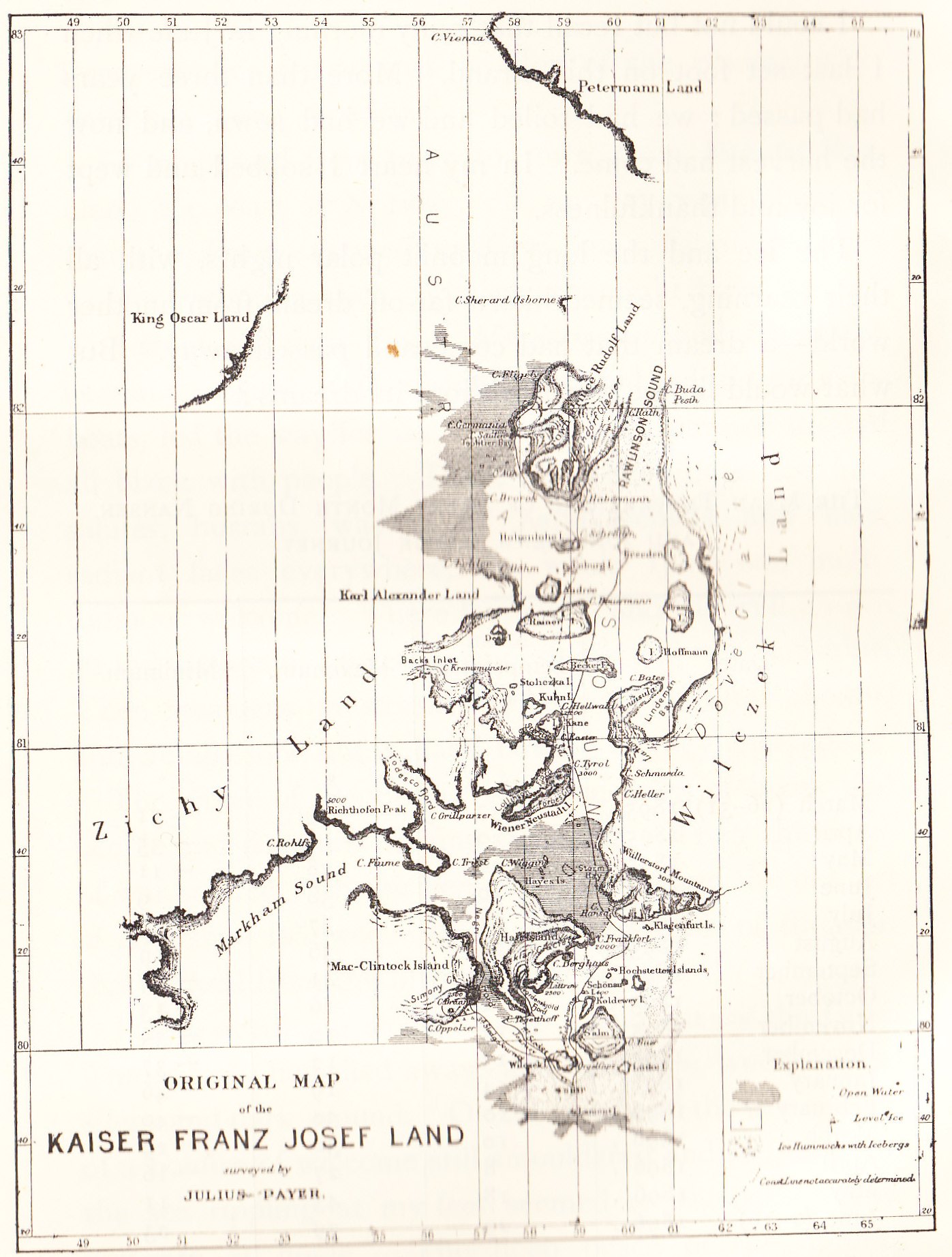
Payer’s early archipelago
Julius Payer
An early outline of Franz Josef Land, preserved in Nansen’s later account. Compare its broad land divisions with the detail on Jackson’s survey.
Source & image credits
- Expedition
- Austro-Hungarian expedition, 1872–1874
- Date & publication
- The archive dates the cartography to approximately 1874; this reproduction comes from a book published in 1897. Reproduced in Farthest North, volume II, Constable & Co., London, 1897.
- Image description
- Old map of the Franz Josef Land archipelago drawn by Julius Payer.
- Credit
- Julius Payer; scan via Wikimedia Commons, from Fridtjof Nansen’s Farthest North.
- Rights
- Public domain (Commons: PD-US). Full scan unchanged; thumbnail resized.
 1874
1874Historical map
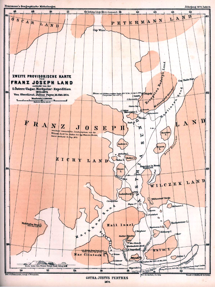
Petermann’s provisional chart
August Petermann
A provisional chart compiled from the Austro-Hungarian expedition. Its title makes the tentative nature of this early mapping explicit.
Source & image credits
- Expedition
- Austro-Hungarian expedition, 1872–1874
- Date & publication
- 1874 is the map date supplied by the archive. Petermanns Mittheilungen, 1874.
- Image description
- August Petermann’s provisional map of Franz Josef Land (1874), based on the Austro-Hungarian North Pole expedition.
- Credit
- August Petermann; Petermanns Mittheilungen, 1874; via Wikimedia Commons.
- Rights
- Public domain. Full scan unchanged; thumbnail resized.
 1896
1896Historical map
Nansen’s Franz Josef Land
Fridtjof Nansen
Nansen’s map from the German edition of his expedition account, documenting the islands in the period of his journey with Hjalmar Johansen.
Source & image credits
- Expedition
- Nansen and Johansen, 1895–1896
- Date & publication
- Commons dates the map to 1896; the source book was published in 1897. In Nacht und Eis, volume II, Brockhaus, Leipzig, 1897.
- Image description
- Nansen’s map of Franz Josef Land (1896).
- Credit
- Fridtjof Nansen; In Nacht und Eis, 1897; scan via Wikimedia Commons.
- Rights
- Public domain. Full scan unchanged; thumbnail resized.
 1898
1898Historical map
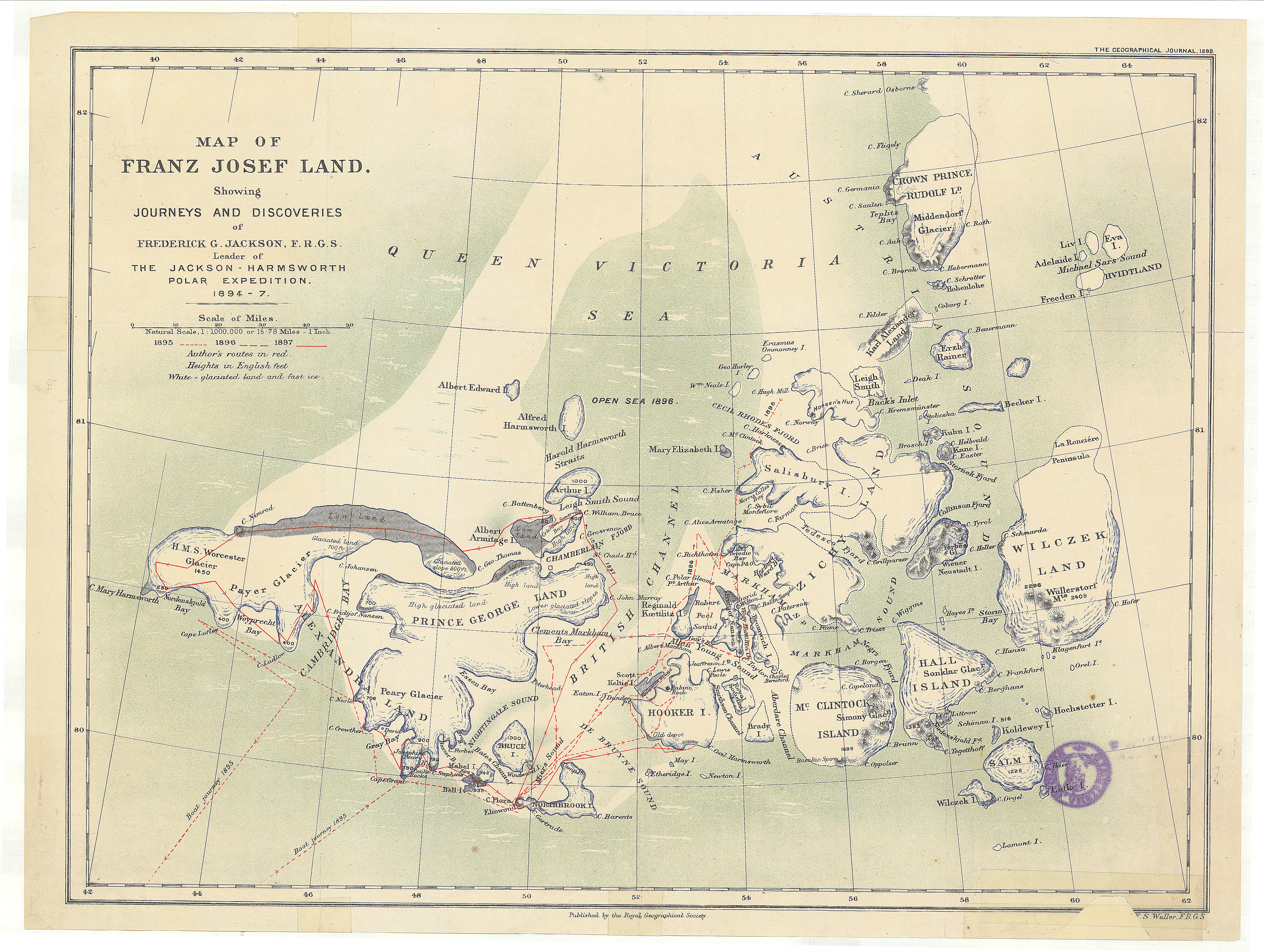
Jackson’s journeys & discoveries
Royal Geographical Society
A detailed colour map accompanying Jackson’s account of three years of exploration. The scan comes from the University of Amsterdam’s Special Collections.
Source & image credits
- Expedition
- Jackson–Harmsworth expedition, 1894–1897
- Date & publication
- Published in 1898, after the expedition of 1894–1897. The Geographical Journal, volume 11, no. 2, February 1898. Printed scale 1:1,000,000.
- Image description
- Map of Franz Josef Land showing journeys and discoveries of Frederick G. Jackson.
- Credit
- Royal Geographical Society; Special Collections of the University of Amsterdam, OTM HB-KZL 61.18.38; via Wikimedia Commons.
- Rights
- Public domain. Full scan unchanged; thumbnail resized.
 1905
1905Historical map
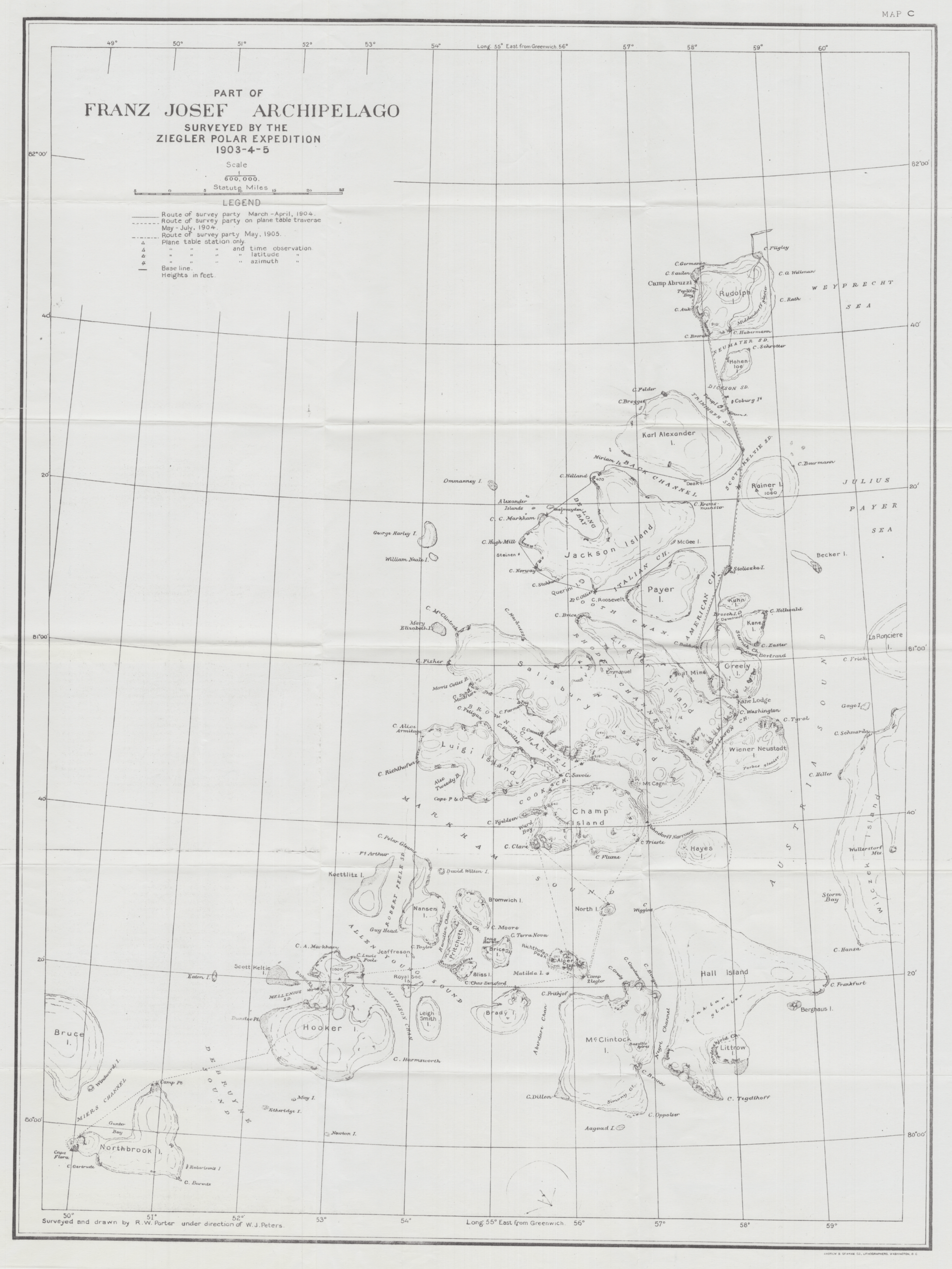
Porter’s expedition survey
Russell Williams Porter
A map of surveys by Russell Porter and Anton Vedoe during the Ziegler–Fiala expedition. It charts part of the archipelago.
Source & image credits
- Expedition
- Ziegler–Fiala expedition, 1903–1905
- Date & publication
- The archive dates the map to 1905; the surveys cover 1903–1905. From Anton Vedoe’s Arctic diary, via the Norwegian Polar Institute.
- Image description
- Part of Franz Josef Archipelago surveyed by the Ziegler Polar Expedition 1903-4-5.
- Credit
- Russell Williams Porter; Anton Vedoe’s Arctic diary, Norwegian Polar Institute; via Wikimedia Commons.
- Rights
- CC BY 4.0. Full scan unchanged; thumbnail resized.
 2009
2009Modern reconstruction
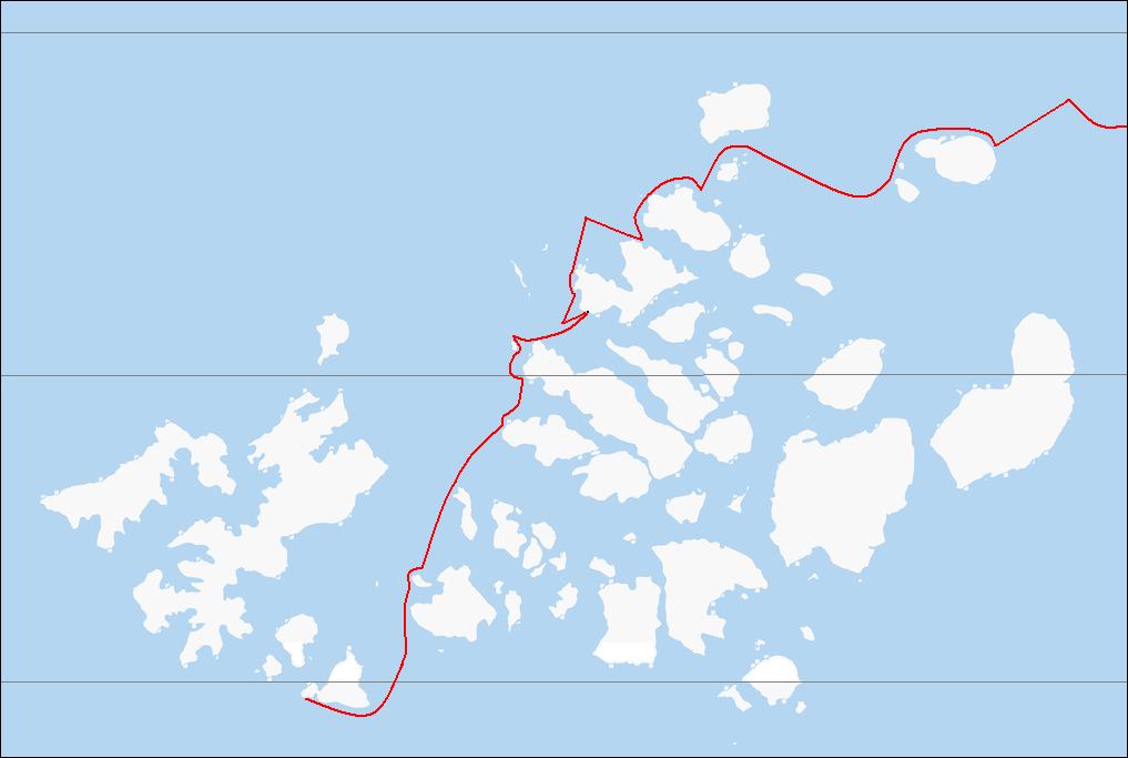
Nansen’s route reconstructed
OpenStreetMap & Ruhrfisch
A later illustration of Nansen and Johansen’s journey, drawn over an OpenStreetMap base. The red route is based on Nansen’s 1897 account.
Source & image credits
- Expedition
- Nansen and Johansen, 1895–1896
- Date & publication
- 2009 dates this illustration. The historical journey shown took place between August 1895 and June 1896. Modern illustration uploaded to Wikimedia Commons in October 2009.
- Image description
- Unlabelled base map showing Nansen and Johansen’s path through Franz Josef Land, August 1895 to June 1896.
- Credit
- OpenStreetMap contributors and Ruhrfisch; route based on Fridtjof Nansen’s Farthest North (1897); via Wikimedia Commons.
- Rights
- CC BY-SA 4.0. Full scan unchanged; thumbnail resized.
About the collection & how to compare maps
This is a curated selection, not a complete catalogue. Dates refer to the map or illustration; publication dates and expedition years are listed separately. Approximate dates retain “c.”. A modern reconstruction is labelled by the year it was drawn, not the year of the voyage.
These images preserve historical geography, names, and uncertainty. They have not been georeferenced or corrected. Apparent differences may reflect surveys, projections, scale, or drafting choices; they are not measurements of coastal or glacier change. Compare labels and features visually, using each panel’s independent controls.
Each map links to its archive record and rights statement. Full scans are bundled unchanged; thumbnail copies are resized for the collection. Image resolution limits how much detail zooming can reveal. Metadata reviewed 2 October 2026.