

Short Answer
Champ Island (Остров Чамп) lies in the central part of the Franz Josef Land archipelago, a remote cluster of islands in the Barents Sea that marks the northernmost extents of Russia and Eurasia. The island is most famous for a field of unusually regular, spherical stones that dot its tundra, the largest of which reach three metres in diameter. These “stone spheres” have attracted geologists, paleontologists, and even popular speculation for more than a century.
The spheres are scattered across a gently rising, ice‑free plateau that slopes upward between two jagged outcrops. The most prominent specimen, known locally as the “Guardian of the Island,” stands alone on a low ridge and is a popular subject of photographs. Their remarkable geometry, the presence of an organic‑looking core, and the variety of mineral assemblages have led to several competing formation models that remain unresolved.
Location
Champ Island is situated in the eastern sector of Franz Josef Land, roughly 30 km east of Gukera Island and about 70 km south‑south‑west of the northernmost point of Rudolf Island. The island’s centre lies at approximately 80°45′ N latitude and 57°30′ E longitude. Administratively it belongs to Arkhangelsk Oblast and is incorporated into the Russian Arctic National Park, which protects the entire archipelago.
Map
Early cartographic depictions of the archipelago omitted Champ Island, as the Austro‑Hungarian North‑Pole Expedition (1873) recorded only the larger islands. The island first appeared on a detailed Russian chart produced after the 1904 Anthony Fiala expedition, where it was labelled “Ostrov Champ” after the expedition’s assistant. Subsequent Soviet charts of the 1930s solidified the name, and modern Russian Navy maps show the island as a roughly oval landmass, 6 km long (north‑south) and 4 km wide (east‑west). The “Guardian” stone is marked on the 1975 topographic map at the island’s central ridge.
Geography
The island is low‑lying, with its highest point reaching about 115 m above sea level on a gentle dome of weathered rock. The coastline is indented by two small bays, one on the western flank (Bay of the Silent) and a smaller inlet on the southeast (Kurov Bay). The interior is largely tundra, free of permanent ice during the short summer, allowing the stone spheres to be visible from the sea.
Glaciers and Ice Cover
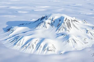
Unlike many of the larger Franz Josef Land islands, Champ Island hosts no significant glaciers. Small perennial snowfields persist in the highest northern ridge, covering less than 5 % of the island’s area. The lack of extensive ice cover has facilitated the preservation and study of the stone spheres.
Geology
The bedrock of Champ Island consists chiefly of Jurassic–Cretaceous marine sediments, predominantly sand‑stone interbedded with siltstone and occasional basaltic intrusions. Analyses of the spheres reveal a core of organic‑looking material surrounded by a matrix rich in quartzite and the mineral маркaзит (marcasite), a iron‑sulphide that forms under low‑oxygen conditions.
Three principal formation hypotheses dominate the scientific discussion:
- Marine‑sedimentary accretion: Valery Arnoldovich Vernikovsky (Novosibirsk State University) argues that the spheres originated on the sea floor when shells of quartzite‑rich molluscs settled in soft marine muds and, under pressure and low temperature, crystallised into spheroidal forms. Subsequent uplift of the Franz Josef Land block and glacial erosion exposed the spheres on land.
- Volcanic‑erosional rounding: Austrian geologist Zeppe Friedhuber suggests that the islands were once overlain by soft volcanic tuff. Continuous melt‑water flow from a retreating glacier created circular basins that eroded the tuff into rounded forms. This model accounts for the spheres’ smooth surfaces but struggles to explain the large three‑metre specimens.
- Organic‑core hypothesis: Russian polar researcher Viktor Boyarsky notes that many spheres contain a distinct organic‑looking nucleus, implying that a biological component (perhaps a fossilised plant or animal tissue) acted as a nucleation centre around which mineral precipitation occurred.
All three models agree that the spheres are not of extraterrestrial origin, despite occasional speculation. Ongoing isotopic dating and micro‑structural studies aim to resolve the debate.
Wildlife
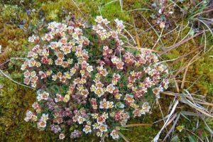
The ice‑free summer terrain supports typical high‑Arctic tundra flora and provides breeding grounds for several seabird species, notably the ivory gull (Pagophila eburnea) and Brünnich’s guillemot (Uria lomvia). The surrounding waters are frequented by walruses (Odobenus rosmarus) and occasional polar bears (Ursus maritimus) that use the island’s shoreline as a haul‑out.
Exploration History
Champ Island was first sighted during the Austro‑Hungarian North‑Pole Expedition of 1873, led by Karl Weyprecht and Julius Payer, though it was not named at that time. The island entered the geographic record after the American‑British Fiala expedition (1904‑1905), when Anthony Fiala’s assistant, a man named Champ, helped chart the island’s coast. The name “Champ Island” was subsequently adopted in Russian charts.
During the Soviet period, the nearby Gukera Island hosted the first Russian polar station in Tikhaya Bay (1929), but Champ Island remained uninhabited, visited only by occasional scientific parties. In the 1970s, a Soviet geologic survey team documented the stone spheres and sent specimens to the Institute of Arctic Geology in St. Petersburg.
Historic Sites
No permanent structures exist on Champ Island. The most notable human-made feature is a modest cairn erected by the 1972 Soviet field party near the “Guardian” stone, bearing an inscription in Russian that records the date of the visit (23 July 1972). The cairn remains largely intact and is protected as part of the island’s cultural heritage.
Scientific Research
Since the 1970s, Champ Island has been a focal point for multidisciplinary Arctic research. Recent projects include:
- A 2018 joint Russian–German isotope study that sampled sphere cores to determine formation ages, suggesting a Late Pleistocene origin.
- A 2021 remote‑sensing survey using UAV‑based photogrammetry to map the spatial distribution of the spheres and model their erosion rates.
- Ongoing monitoring by the Russian Arctic National Park Service, which records seasonal changes in vegetation cover and wildlife use of the island.
Name Origin
The island’s English name derives from “Champ,” the surname of Anthony Fiala’s assistant who participated in the 1904 expedition to the North Pole. Russian charts transliterate the name as “Остров Чамп.” No earlier indigenous names are recorded, reflecting the island’s lack of permanent human presence.
Neighboring Islands and Straits
Champ Island lies east of Gukera Island, separated by the 3 km‑wide Gukera – Champ Strait. To the north, the larger Rudolf Island dominates the horizon, while to the south‑west the smaller Ostrov Kamennyy is linked by a shallow shoal that becomes ice‑bound in winter.
FAQ
What are the stone spheres on Champ Island made of?
The spheres consist mainly of quartzite and the mineral marcasite, often surrounding an organic‑looking core.
How old are the stone spheres?
Isotopic dating suggests they formed during the Late Pleistocene, roughly 12,000–15,000 years ago, though precise ages are still under study.
Can visitors climb the spheres?
Champ Island is part of a protected national park; climbing is discouraged to preserve the fragile geological formations.
Are similar spheres found elsewhere in the Arctic?
Similar spheroidal rocks have been reported on a few other Franz Josef Land islands, but none match the size and abundance of those on Champ Island.
What is the most accepted theory for their formation?
The marine‑sedimentary accretion model, supported by Vernikovsky, currently has the most scientific backing, though the debate continues.




Leave a Reply