

Short Answer
Location
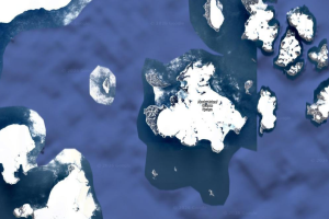
Alexandra Land lies at 80°38′02″ N 46°35′02″ E, forming the westernmost substantial island of the Franz Josef Archipelago in the Arctic Ocean. Administratively it belongs to Arkhangelsk Oblast, Russia.
Map
The island is separated from the neighboring Zemlya Georga by the Cambridge Channel (Proliv Kambritch). To its south‑west the Dezhnev Bay (Zaliv Dezhneva) defines the boundary between the glaciated interior and the Polyarnykh Letchikov Peninsula.
Geography
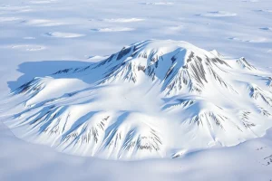
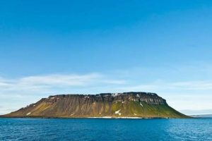
Covering roughly 1,050 km², Alexandra Land stretches about 70 km east‑west and 30 km north‑south. The western half is dominated by the ice dome Kupol Lunny (382 m a.s.l.), while the northern sector remains ice‑free. The eastern promontory, the Polyarnykh Letchikov Peninsula, is capped by a smaller dome, Kupol Kropotkina.
Three sizable freshwater lakes punctuate the interior, the most notable being Utinoye Lake (“Duck Lake”) and Ledyanoye Lake (“Ice Lake”). The island’s coastline features several capes: Cape Mary Harmsworth (the westernmost point of the archipelago), Cape Thomas on the peninsula’s southern tip, and the twin capes Lofley and Ludlow that project southwest at the island’s southern end.
Glaciers
| Glacier | Location | Notes |
|---|---|---|
| Nordenskiöld Glacier | Western glaciated zone, near Dezhnev Bay | Largest outlet glacier on the island |
| Worcester Glacier | South‑central part, draining toward Cambridge Channel | Named after HMS Worcester expedition |
| Payer Glacier | Eastern flank of the ice dome | Honors explorer Julius Payer |
Geology
The island’s bedrock consists primarily of late‑Precambrian to early‑Paleozoic metamorphic complexes, typical of the Arctic continental margin. The dominant lithologies are gneisses and schists, intruded locally by granitic dykes that record multiple phases of Caledonian orogeny. Permafrost underlies the entire island, reaching depths of 150 m in the interior ice‑free zones.
Wildlife
Alexandra Land supports a sparse but ecologically important Arctic fauna. Polar bears (Ursus maritimus) are the apex predators, with a genetically distinct subpopulation documented in the region. Seasonal visitors include ringed seals (Pusa hispida) along the ice‑edge and occasional walrus haul‑outs on the low‑lying coastal outcrops. Avian life is limited to migratory seabirds such as the ivory gull (Pagophila eburnea) that nest on exposed cliffs during the brief summer.
Exploration History
The first recorded sighting was by English explorer Benjamin Leigh Smith in 1880, who named the area after Princess Alexandra, then Princess of Wales. The Jackson–Harmsworth expedition under Frederick Jackson made the first landing in 1895, establishing the name and mapping the island’s coastline. In 1914, Russian navigator Valerian Albanov reached Cape Mary Harmsworth after his dramatic drift on the ship Svyataya Anna.
During World II, German forces erected a short‑lived meteorological station called “Schatzgräber”; the crew suffered trichinosis from raw polar‑bear meat and the station was abandoned. In the Cold War era the Soviet Air Defence Forces operated the 31st Independent Radio‑Technical Company (Military Unit 03184) on the island.
Historic Sites
Remnants of the German meteorological station, the Soviet radio‑technical complex, and early 20th‑century cairns remain scattered across the island. The most prominent modern facility is the Nagurskoye airfield, originally built in the 1950s and expanded in the 2010s into the “Arctic Trefoil” complex, capable of housing 150 personnel for up to 18 months.
Scientific Research
Since the reopening of Nagurskoye in 2017, the base has served as a hub for multidisciplinary Arctic research, including atmospheric monitoring, permafrost studies, and marine biodiversity surveys. The 1,500 m snow runway supports Antonov An‑72 and Ilyushin Il‑76 cargo operations, enabling the transport of scientific equipment and personnel.
Name Origin
The island’s name commemorates Princess Alexandra of Wales, as recorded by Leigh Smith’s 1880 expedition. An alternative, less‑substantiated account links the name to Grand Duchess Alexandra Pavlovna of Russia, but the former explanation is the one accepted by most historical authorities.
Related Islands
Within the Franz Josef Archipelago, other principal islands include:
- Zemlya Georga – lies east of Alexandra Land across the Cambridge Channel.
- Prince George Land – the southeastern island identified by Jackson in 1897.
- Franz Josef Island – the central and largest island of the archipelago.
FAQ
What is the strategic importance of Nagurskoye base on Alexandra Land?
Nagurskoye provides Russia with a year‑round foothold in the high Arctic, supporting air operations, meteorological monitoring, and scientific research while reinforcing sovereign claims over the region.
Which glaciers are present on Alexandra Land and how are they monitored?
The island hosts the Nordenskiöld, Worcester and Payer glaciers. They are observed via satellite remote sensing, GPS stake networks installed during summer field campaigns, and aerial surveys launched from Nagurskoye.
Are polar bears resident on Alexandra Land year‑round?
Polar bears use the island seasonally; they are most commonly sighted during the spring melt when sea ice retreats, but some individuals remain on the ice‑free northern coast throughout summer.


Leave a Reply