
Short Answer
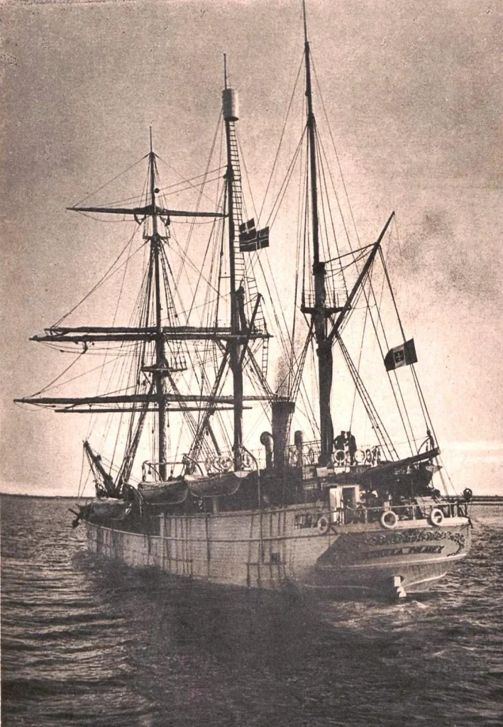
The Stella Polare Expedition was an Italian Arctic venture launched in 1899 by Prince Luigi Amedeo, Duke of the Abruzzi, a noted mountaineer and explorer. After acquiring a steam whaler in Oslo and renaming it Stella Polare, the duke assembled a multinational crew to attempt the highest attainable latitude in the high Arctic, with the ultimate ambition of reaching the North Pole.
Departing Norway in the summer of 1899, the expedition entered the remote archipelago of Franz Josef Land, where it wintered on the sea ice and later launched dog‑sled sledge parties to push farther north. The mission combined bold geographical aims with a comprehensive scientific programme that recorded meteorological, magnetic, and oceanographic data, and produced detailed cartographic sketches of previously uncharted islands.
Who Was the Expedition
Prince Luigi Amedeo (1873–1931), a grandson of King Vittorio Emanuele II of Italy, had earned fame as a climber of the Alps and the Himalayas before turning his attention to polar travel. The expedition’s core personnel included Captain Umberto Cadorna (ship commander), Lieutenant Luigi Bianchi (navigation officer), Dr. Giovanni Guglielmo (physician and naturalist), and a team of seasoned sailors, engineers, and several Norwegian and Russian dog‑handlers. The vessel Stella Polare, originally a Norwegian steam whaler built in 1875, was refitted in Oslo with reinforced hull plating and a small laboratory on deck.
Objectives
The stated goals were threefold: (1) to reach the highest possible latitude in the Arctic and possibly the North Pole; (2) to establish a winter base on the ice of Franz Josef Land for continuous observation; and (3) to perform a systematic scientific survey of the archipelago’s geography, geology, meteorology, and magnetic field. Funding came from the Italian royal court, private patrons, and modest contributions from the Royal Geographical Society, which supplied navigation instruments and a magnetic observatory kit.
Route
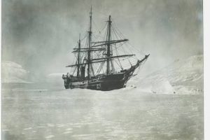
The expedition set sail from Oslo on 24 June 1899, stopping briefly at Tromsø for final provisions. By early August the steamship had entered the Barents Sea and, after navigating the narrow straits between the archipelago’s western islands, anchored in the vicinity of Cape Blenheim on Rudolf Island (approximately 81°49′ N, 58°57′ E). The ship became ice‑bound on 14 August and remained trapped for the winter months, drifting with the pack ice while the crew erected a temporary ice camp and a modest laboratory shelter.
In late March 1900 the ice began to break up, allowing the crew to launch sledges equipped with dogs, sledges, and portable scientific instruments. From the ice camp they trekked northward across the frozen sea, establishing depots on Hall Island and further on the northern coast of Rudolf Island. On 12 August 1900 the party reached latitude 86°34′ N, the highest point ever attained by a surface expedition at that time, before turning back toward the ship.
Timeline
| Date | Event |
|---|---|
| 24 June 1899 | Departure from Oslo, Norway |
| 5 August 1899 | Entered Franz Josef Land waters; sighted Rudolf Island |
| 14 August 1899 | Stella Polare became ice‑bound near Cape Blenheim |
| December 1899 – March 1900 | Wintering on pack ice; scientific observations conducted |
| Late March 1900 | Ice breakup; sledges launched for northward push |
| 12 August 1900 | Reached record latitude 86°34′ N |
| 30 August 1900 | Return to ship; began southward voyage |
| 14 September 1900 | Departure from Franz Josef Land |
| 2 October 1900 | Arrival in Oslo; expedition concluded |
The Franz Josef Land Connection
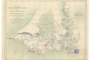
Franz Josef Land, an uninhabited archipelago of roughly 190 islands in the Barents Sea, served as the expedition’s principal arena. The ice camp was established on a stable floe east of Cape Blenheim, providing a platform for continuous meteorological recordings that later proved valuable for understanding Arctic winter dynamics. The sledging routes traversed previously unmapped sections of Hall Island, Salm Island, and the northern coast of Rudolf Island, allowing the crew to produce the first reliable topographic sketches of these areas. Their observations corrected earlier cartographic errors from the Austro‑Hungarian North‑Pole Expedition (1873) and added new place‑names that entered later Russian and Soviet charts.
Challenges and Hardships
Ice conditions proved the expedition’s greatest adversary. The ship’s hull was repeatedly battered by pressure ridges, forcing the crew to employ explosives to free the vessel from a thick keel of ice in early 1900—a dramatic episode recorded in the expedition’s narrative (source: Cambridge Core). Food supplies dwindled during the long winter, necessitating careful rationing of preserved meat, hardtack, and seal oil. Scurvy threatened the crew until fresh seal meat was secured during a brief open‑water excursion in April 1900. Extreme cold, with temperatures dropping below –30 °C, and frequent blizzards hampered sledging progress and caused several dog deaths.
Discoveries and Achievements
The expedition’s most celebrated achievement was the attainment of 86°34′ N on 12 August 1900, surpassing the previous record set by the Jackson–Harmsworth Expedition (1894–1897). Scientific outputs included a continuous series of barometric pressure readings, temperature logs, and magnetic declination measurements taken from the ice camp, which were later incorporated into the International Polar Year (1902–1903) datasets. Cartographically, the team produced the first accurate coastal surveys of Hall Island and the northern shoreline of Rudolf Island, correcting the phantom islands depicted on Payer’s 1875 map. The expedition also collected geological specimens of Jurassic–Cretaceous marine sediments and a modest collection of Arctic flora.
Outcome and Fate
Stella Polare freed herself from the pack ice in late August 1900 and returned to Oslo in early October. The ship was later sold to a Norwegian whaling company and continued in commercial service until scrapped in 1915. Prince Luigi Amedeo published his account in Italian in 1902 (“Il Polare”) and an English translation appeared in 1903, edited by William Le Queux (Cambridge University Press, 2014). The duke never again attempted a polar voyage, but his later African and Asian expeditions cemented his reputation as a versatile explorer.
Historical Significance
Historians regard the Stella Polare Expedition as a bridge between the heroic age of early Arctic exploration and the more systematic scientific endeavors of the early twentieth century. Its successful high‑latitude penetration demonstrated the feasibility of wintering on sea ice for extended scientific work, influencing later Soviet Arctic programs and the British Arctic Air Route Expedition (1930–31). The expedition’s methodological blend of exploration, scientific observation, and cartographic precision set a new standard for polar ventures.
Primary Sources
The principal narrative is Prince Luigi Amedeo’s own two‑volume work, first published in Italian (1902) and translated into English by William Le Queux (1903). Original ship’s logs, meteorological notebooks, and magnetic observation sheets are housed in the Archivio di Stato di Torino and have been digitised by the Italian Polar Institute. Contemporary newspaper reports from *The Times* (London) and *Corriere della Sera* (Milan) provide additional eyewitness accounts. The Cambridge University Press edition (2014) offers a reliable scholarly transcription and annotation of the original text.
Related Expeditions
Earlier attempts to chart Franz Josef Land include the Austro‑Hungarian North‑Pole Expedition (1872–73) led by Julius von Payer and Karl Weyprecht, which first sighted the archipelago. The Jackson–Harmsworth Expedition (1894–97) established a winter base at Cape Flora and performed extensive mapping, setting the stage for the Abruzzi’s later work. Later Soviet expeditions, notably the 1931–32 Chelyuskin rescue operation, benefitted from the cartographic foundations laid by the Stella Polare team.
FAQ
What was the highest latitude reached by the Stella Polare Expedition?
The expedition reached 86°34′ N on 12 August 1900, which was the highest latitude ever attained by a surface expedition at that time.
How did the expedition free the ship from the ice?
When the hull became immobilised by thick pack ice in early 1900, the crew used controlled explosives to break the surrounding ice floes, allowing Stella Polare to drift free.
Did the expedition conduct scientific research?
Yes; continuous meteorological, magnetic, and oceanographic observations were recorded from the ice camp, and detailed coastal surveys of several islands were produced.

Leave a Reply