
Short Answer
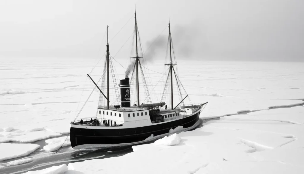
The Austro‑Hungarian North‑Pole Expedition, commonly referred to as the Tegetthoff Expedition, set sail in summer 1872 with the explicit aim of probing the high Arctic for a navigable Northeast Passage. Under the dual command of naval officer Karl Weyprecht and cartographer‑explorer Julius Payer, the expedition’s flagship, the three‑masted barkentine Tegetthoff, was equipped with a 100‑horsepower steam engine—a novelty for polar voyages of the era.
After a winter of entrapment in pack ice north of Novaya Zemlya, the vessel drifted eastward into uncharted waters. On 30 August 1873 the crew sighted a chain of ice‑capped islands, which they named Franz Josef Land after the Austro‑Hungarian emperor. Over the following months the expedition carried out a series of sledge journeys, collected scientific observations, and produced the first systematic maps of the archipelago. The Tegetthoff finally broke free of the ice and returned to Tromsø in August 1874, having contributed a wealth of geographic, hydrographic and meteorological data.
Who Was the Tegetthoff Expedition
The expedition was organized by the Austrian Geographical Society and financed primarily by aristocratic patrons, most notably Count Johann Nepomuk Wilczek (ƒ30,000) and Count Franz Salm (ƒ20,000). The ship’s construction was undertaken by the Bremerhaven yard Teklenborg & Beurmann, resulting in a 220‑ton barkentine 38.34 m in length, rigged for sail but reinforced with a 100‑hp (75 kW) steam engine for ice navigation.
The crew of 24 was drawn from across the Austro‑Hungarian Empire, with a strong representation from the Adriatic coast. Key personnel included:
- Karl Weyprecht – commander of the vessel, former officer of the Austrian navy.
- Julius Payer – leader of the terrestrial surveys and cartographer.
- Gustav Brosch – first officer.
- Eduard Orel – second officer.
- Dr. Julius Kepes – ship’s physician.
- Elling Carlsen – ice pilot and harpooneer from Tromsø.
- Various sailors recruited from Dalmatia, Istria and other coastal regions.
The expedition also carried two Lapland dogs, six Viennese dogs and two cats for companionship and sled pulling.
Objectives
The official programme combined geographic, scientific and commercial goals:
- Explore the Arctic Ocean north of Russia in order to locate a possible Northeast Passage.
- Search for land that could serve as a base for a future attempt to reach the North Pole by sea.
- Conduct systematic hydrographic sounding, magnetic and meteorological observations.
- Collect botanical, zoological and geological specimens for the Imperial Natural History Museum in Vienna.
- Produce accurate charts of any newly discovered coastlines.
These aims reflected the influence of geographer August Petermann, who had advocated for a navigable northern sea based on the Gulf Stream’s moderating effect.
Route
The expedition’s itinerary can be divided into three phases:
- Outbound leg (13 July 1872 – end of August 1872): Tegetthoff departed Tromsø, Norway, and sailed northward along the coast of Novaya Zemlya, rendezvousing with the auxiliary schooner Isbjørn to establish an emergency supply depot at Cape Nassau.
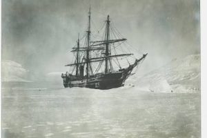
- Ice drift and discovery (late August 1872 – 22 October 1873): The ship became trapped in pack ice north of Novaya Zemlya. Over the next year it drifted eastward, crossing the Barents Sea and eventually entering the vicinity of the unknown islands. On 30 August 1873 the crew sighted the southeastern coast of what they would name Franz Josef Land. By 22 October the vessel halted near the southeast corner of the archipelago, near present‑day Cape Fligely on Rudolf Island.
- Return (November 1873 – 22 August 1874): After a brief period of coastal surveying, Tegetthoff broke free of the ice, sailed southward along the western coast of Franz Josef Land, and finally navigated back through the Barents Sea to Tromsø, where the expedition disembarked.
Timeline
| Date | Event |
|---|---|
| 20 June 1872 | Isbjørn departs Tromsø to lay a depot at Cape Nassau (Novaya Zemlya). |
| 13 July 1872 | Tegetthoff leaves Tromsø with 24 crew members. |
| End August 1872 | Ship becomes ice‑bound north of Novaya Zemlya. |
| 30 August 1873 | Discovery of Franz Josef Land; first landfall on Cape Fligely (Rudolf Island). |
| 22 October 1873 | Tegetthoff halts near southeast Franz Josef Land after a year of drift. |
| November 1873 – March 1874 | Sledge surveys of islands; collection of scientific data. |
| August 1874 | Expedition returns to Tromsø; Tegetthoff arrives safely. |
The Franz Josef Land Connection
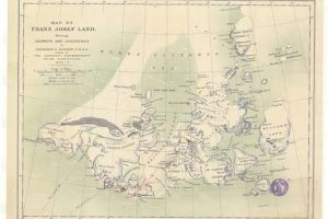
The expedition’s most enduring legacy is the discovery and initial mapping of Franz Josef Land, an archipelago of roughly 190 islands extending from 80° N to 82° N and spanning about 16 000 km². Payer’s field sketches, later refined in Vienna, produced the first accurate charts, naming major islands after Austrian dignitaries (e.g., Rudolf Island, Hall Island, Ziegler Island). These maps were incorporated into the Austro‑Hungarian Imperial Navy’s charts and remained the definitive reference until the Russian surveys of the 1920s.
The sledge parties established a temporary base at Cape Fligely, where they erected a modest stone cairn bearing the expedition’s name. From this position they explored the surrounding islands, documented glaciation, and recorded meteorological data that would later serve as a baseline for Arctic climate studies.
Challenges and Hardships
Ice proved the expedition’s greatest adversary. After the initial entrapment, the crew endured continuous threats of hull crushing, forcing them to prepare for abandonment on several occasions. Food supplies were stretched thin; the crew supplemented rations with seal meat and the dogs they had brought. Scurvy was a constant risk, mitigated by the inclusion of fresh meat and the presence of a ship’s doctor, Dr. Julius Kepes, who monitored the crew’s health.
Weather conditions were extreme, with polar night setting in during the winter months and temperatures regularly dropping below –30 °C. Navigation was hampered by the absence of reliable magnetic compasses near the magnetic pole, necessitating frequent celestial observations.
Discoveries and Achievements
Beyond the discovery of the archipelago, the expedition achieved several scientific milestones:
- Systematic hydrographic sounding of the Barents Sea, extending knowledge of depth contours between Novaya Zemlya and the newly found islands.
- Magnetic declination measurements that contributed to the refinement of the World Magnetic Model for high latitudes.
- Comprehensive meteorological records (temperature, pressure, wind) spanning a full Arctic year, providing one of the earliest continuous datasets for the region.
- Geological sampling that identified Jurassic–Cretaceous marine sediments and isolated basaltic outcrops, hinting at the archipelago’s complex tectonic history.
- Biological collections of Arctic flora, fauna and avian eggs, many of which were new to European science at the time.
The cartographic output, published as “Karte des Franz‑Josef‑Landes” in 1875, remained the authoritative map until Soviet aerial photography in the 1930s.
Outcome and Fate
Tegetthoff returned to Tromsø in August 1874 without loss of life, a remarkable outcome given the harsh conditions. Weyprecht and Payer were hailed as heroes in Vienna; Weyprecht later became a founder of the International Polar Year (1882‑83). The expedition’s scientific reports were disseminated through the Austrian Geographical Society and influenced subsequent polar ventures, including the Jackson‑Harmsworth Expedition (1894‑95) and the early 20th‑century Russian attempts to reach the North Pole.
Historical Significance
Historians consider the Tegetthoff Expedition a turning point in Arctic exploration for three reasons:
- It demonstrated the strategic advantage of steam power for polar navigation, prompting other nations to equip their ships similarly.
- The discovery of Franz Josef Land opened a new arena for scientific inquiry and later served as a staging ground for early 20th‑century polar races.
- The expedition’s meticulous cartography set a new standard for Arctic mapping, influencing both civilian and military charting efforts.
Primary Sources
The expedition’s legacy is preserved in several contemporary documents:
- The two‑volume narrative “Die österreichisch‑ungarische Nordpol‑Expedition 1872‑1874” published in Vienna (1876) by Weyprecht and Payer, containing full ship logs, scientific tables and Payer’s field sketches.
- Original ship’s logbooks, now housed in the Austrian State Archives, which detail daily ice conditions, temperature readings and navigational decisions.
- Cartographic plates produced by Payer’s office, reproduced in the 1875 “Karte des Franz‑Josef‑Landes”.
- Correspondence between Count Wilczek and the Imperial Navy, illuminating the financial and political backing of the venture.
Related Expeditions
The Tegetthoff Expedition built upon the 1871 reconnaissance voyage of the Isbjørn, which had already demonstrated the feasibility of a supply depot at Cape Nassau. It also set the stage for later Arctic forays:
- Jackson‑Harmsworth Expedition (1894‑95) – British‑led, used Franz Josef Land as a base for further northward sledge journeys.
- Wellman’s 1898 Expedition – American attempt to reach the North Pole, which wintered at Cape Flora on Northbrook Island.
- Soviet annexation (1926) – The archipelago was formally incorporated into the USSR, leading to the establishment of research stations such as the Ernst Krenkel Observatory.
FAQ
What was the primary purpose of the Tegetthoff Expedition?
To explore the Arctic Ocean north of Russia, search for a Northeast Passage, and investigate the possibility of a base for a future North‑Pole sea expedition.
How did the expedition discover Franz Josef Land?
After being trapped in pack ice north of Novaya Zemlya, the ship drifted eastward and on 30 August 1873 sighted the previously unknown island chain, which the crew named Franz Josef Land.
What role did steam power play in the expedition?
The Tegetthoff’s 100‑hp steam engine allowed limited ice‑breaking and maneuvering, proving that steam propulsion could extend the operational window of polar vessels compared to pure sailing ships.
Did any members of the expedition die during the journey?
No. All crew members survived the two‑year voyage, despite severe ice pressure, cold, and limited rations.
What lasting impact did the expedition have on Arctic cartography?
Payer’s detailed charts of Franz Josef Land became the standard reference for the archipelago for decades, influencing later Russian and British maps and establishing a baseline for future scientific surveys.


Leave a Reply