

Short Answer
Location
Graham Bell Island lies in the eastern sector of the Franz Josef Land archipelago, bordering the Kara Sea and the Barents Sea of the Arctic Ocean. Its geographic coordinates are 80°51′59″ N, 64°17′21″ E.
Map
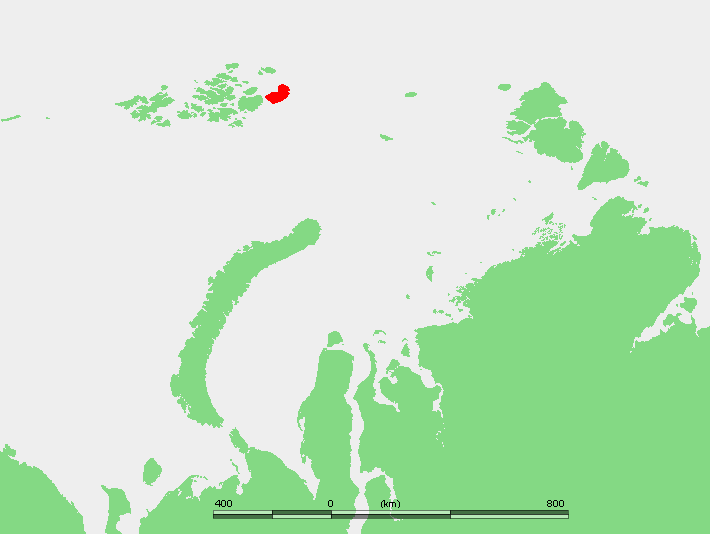
The island is positioned east of Wilczek Land, separated by the narrow Morgan Sound. The easternmost cape, Cape Kohlsaat (81°14′ N, 65°10′ E), marks the north‑western corner of the Kara Sea.
Geography
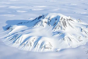
Covering an area of 1,557 km² (601 sq mi), Graham Bell Island is the second‑largest island of the group after Zemlya Frantsa‑Iosifa. Its terrain is dominated by a central ice dome, low‑lying tundra in the periphery, and a rugged coastline punctuated by numerous small islets such as Ostrov Trëkhluchevoy and Ostrov Udachnyy.
Glaciers
| Glacier / Ice Feature | Location | Notes |
|---|---|---|
| Kupol Vetrenyy (Windy Dome) | Western half of the island | Ice dome that includes the island’s highest point, 509 m (1,670 ft) above sea level. |
The remainder of the island is largely ice‑free during the brief Arctic summer, exposing a thin layer of permafrost‑bound soil and sparse vegetation.
Geology
The bedrock of Graham Bell Island consists chiefly of Precambrian to early Paleozoic metamorphic complexes, similar to the rest of the Franz Josef Land archipelago. These rocks have been heavily sculpted by Pleistocene glaciations, leaving striated surfaces, roche moutonnée, and glacial deposits that dominate the landscape.
Wildlife
Despite its extreme latitude, the island supports a modest Arctic fauna. Seasonal visitors include polar bears (*Ursus maritimus*), ringed seals (*Pusa hispida*), and occasional walruses. Bird species such as the ivory gull (*Pagophila eburnea*) and various Arctic terns breed on the coastal cliffs during the summer months.
Exploration History
The island was first recorded on 2 May 1899 by a sledging party of the Wellman expedition, comprising Evelyn Briggs Baldwin, Daniel Johansen, Emil Ellefsen, Olaf Ellefsen, and Paul Bjørvig. Their discovery added a crucial eastern foothold to the mapping of Franz Josef Land.
During the Cold War, the Soviet Union established a military outpost and constructed the Greem Bell airfield on the northeastern tip (81°09′ N, 64°17′ E). The runway, 2,100 m long, accommodated cargo and fighter aircraft throughout most of the year when the ground was sufficiently frozen. The base operated until its closure in 1994, fell into disrepair, and was later slated for reopening by the Russian Air Force in 2012.
Historic Sites
- Greem Bell Airfield – The largest airfield in the archipelago, featuring a 2,100 m runway and remnants of Cold‑War infrastructure.
- Cold‑War Outpost – Ruins of radar, fuel storage, and habitation buildings that illustrate Soviet Arctic military presence.
- Cape Kohlsaat Monument – A modest commemorative plaque placed in the 1970s marking the easternmost point of the archipelago.
Scientific Research
Since the early 2000s, Russian polar institutes have used the island as a logistical hub for glaciological and climate studies, particularly focusing on the dynamics of the Kupol Vetrenyy ice dome. Seasonal meteorological stations record temperature, wind, and sea‑ice conditions, contributing to long‑term Arctic climate datasets.
Name Origin
The island was named in honour of the Scottish‑American inventor Alexander Graham Bell, reflecting the tradition of commemorating notable figures in polar toponymy.
Related Islands
Neighbouring islands within Franz Josef Land that share geological and historical ties include:
- Wilczek Land – separated by Morgan Sound.
- Bell Island – a smaller island named for its shape, not the inventor.
- Ostrov Trëkhluchevoy – a 2 km islet off the western shore.
- Ostrov Udachnyy – part of a cluster along the north‑western coast.
FAQ
When was Graham Bell Island first discovered?
The island was first recorded on 2 May 1899 by a sledging party of the Wellman expedition.
What is the significance of the Greem Bell airfield?
Built during the Cold War, it was the largest runway in the archipelago (2,100 m) and served Russian cargo and fighter aircraft until its closure in 1994.
Which ice feature dominates Graham Bell Island?
The western half of the island is covered by the Kupol Vetrenyy ice dome, which includes the island’s highest elevation of 509 m.


Leave a Reply