Short Answer
Luigi Island (Russian: Остров Луиджи, Ostrov Luidzhi) forms the westernmost tip of the Zichy Land subgroup within the Franz Josef Land archipelago, a remote high‑Arctic cluster in the Barents Sea. The island’s 371 km² are dominated by a thick mantle of ice, punctuated by a few ice‑free coastal cliffs that provide breeding sites for seabirds and haul‑out spots for marine mammals. Its highest point, a glaciated dome, reaches 442 m above sea level.
Although uninhabited, Luigi Island has played a recurring role in the narrative of polar discovery. First sighted during the Austro‑Hungarian North‑Pole Expedition of 1873, the island was later charted by Julius von Payer and Karl Weyprecht in the 1874–75 surveys that produced the first reliable maps of Franz Josef Land. The island received its present name in the wake of the 1899–1900 Italian expedition led by Prince Luigi Amedeo, Duke of the Abruzzi, honoring his contributions to Arctic mountaineering and exploration.
Location
Luigi Island lies at 80°47′30″ N, 54°57′26″ E (80.7917° N, 54.9572° E) in the high Arctic of the Russian Federation. Administratively it belongs to Arkhangelsk Oblast and, since 2009, to the Russian Arctic National Park, which protects the archipelago’s fragile ecosystems.
Map
The island appears on the earliest Russian‑Austrian charts produced by Payer in 1875, labelled as “Luigi” in the German‑Italian transliteration used by the expedition. British cartographer Admiral Sir Albert Hastings Markham later gave the western strait its name, Markham Channel, after his own Arctic voyages. Modern Russian nautical charts retain the Russian transliteration “Ostrov Luidzhi” while preserving the island’s historic outline: a roughly triangular landmass oriented with its apex pointing north‑west, extending about 30 km east‑west and 25 km north‑south.
Geography
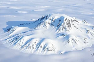
The coastline is indented by several small bays, the most notable being the ice‑free inlet on the southeastern flank that offers limited anchorage for research vessels in summer. The island’s terrain is dominated by a central ice dome that feeds numerous outlet glaciers flowing toward the surrounding seas. Rocky nunataks break the ice surface near the southern coast, providing the only permanent ice‑free outcrops. The island’s highest point, 442 m, sits atop the main dome and offers a rare panoramic view of the Zichy Land cluster.
Glaciers and Ice Cover
Luigi Island is classified as “heavily glacierized.” Ice covers roughly 85 % of the land area, forming a continuous ice cap punctuated by outlet glaciers that descend to the sea along the eastern and southern margins. The ice cap rests on a bed of permafrost and exhibits typical Arctic dome morphology, with a gentle slope toward the surrounding channels. Seasonal meltwater streams are confined to the brief Arctic summer, feeding into the Markham Channel and the nearby Salisbury and Champ Islands.
Geology
Underlying the ice is a sequence of Late Jurassic to Early Cretaceous marine sedimentary rocks, typical of the Franz Josef Land platform. Basaltic sills and dolerite intrusions, emplaced during the Cretaceous, are exposed on the island’s nunataks, offering insight into the archipelago’s volcanic history. The sedimentary layers contain occasional fossiliferous horizons, though the thick ice cover limits extensive field investigation.
Wildlife
Despite its glacial dominance, Luigi Island supports a modest but ecologically significant assemblage of Arctic fauna. The ice‑free cliffs host breeding colonies of ivory gull (Pagophila eburnea) and Brünnich’s guillemot (Uria lomvia). Polar bears (Ursus maritimus) are frequent visitors, using the sea‑ice edges for hunting seals (Phoca hispida). Walruses (Odobenus rosmarus) have been observed hauled out on the southern bays during late summer. The surrounding waters are frequented by bowhead (Balaena mysticetus) and beluga whales (Delphinapterus leucas), which follow the seasonal ice edge.
Exploration History
The Austro‑Hungarian North‑Pole Expedition, aboard the steam‑schooner Tegetthoff, first sighted the Zichy Land islands in 1873, though Luigi Island itself was not directly landed upon until the 1874–75 survey season. Julius von Payer’s cartographic work produced the first reliable depiction of the island, assigning it a provisional name that was later superseded.
In 1899 Prince Luigi Amedeo, Duke of the Abruzzi, led an Italian scientific–military expedition that aimed to explore the western reaches of Franz Josef Land. The expedition’s cartographers formally named the island “Luigi” in honor of the Duke’s leadership and his earlier achievements in the Karakoram and the Arctic. The naming was accepted by the International Hydrographic Organization and entered Russian charts after the Soviet annexation of the archipelago in 1926.
British explorer Sir Albert H. Markham, after whom the adjacent channel is named, surveyed the western approaches in 1901, providing detailed hydrographic data that improved navigation through Markham Channel. During the Soviet era, the island was mapped repeatedly, most notably by the Arctic and Antarctic Research Institute (AARI) in the 1930s and again during the 1970s aerial photographic campaigns.
Historic Sites
Field surveys have identified a small cairn erected by the Abruzzi expedition near the southern inlet, bearing an engraved plaque in Italian that records the date “12 July 1900.” No permanent huts or research stations have ever been constructed on Luigi Island, owing to its extreme glaciation and logistical difficulty. The cairn remains the principal historic artifact, protected under the Russian Arctic National Park’s heritage regulations.
Scientific Research
Modern glaciological work on Luigi Island is conducted primarily by the AARI and international partners using satellite remote sensing (e.g., Sentinel‑1 SAR) and limited field campaigns during the brief summer window. Measurements focus on ice‑cap thickness, outlet‑glacier flow rates, and surface mass balance. A 2020 study published in the Journal of Glaciology reported a modest retreat of the island’s eastern outlet glaciers, consistent with regional warming trends across the Barents Sea sector.
| Date | Event |
|---|---|
| 1873 | Austro‑Hungarian North‑Pole Expedition first sights Zichy Land group. |
| 1874‑75 | Payer’s cartographic survey maps Luigi Island for the first time. |
| 1900 | Duke of the Abruzzi’s expedition names the island “Luigi.” |
| 1926 | Soviet annexation decree incorporates the island into the Russian Arctic. |
| 2009 | Luigi Island becomes part of the Russian Arctic National Park. |
| 2020 | Journal of Glaciology article documents outlet‑glacier retreat. |
Name Origin
The island’s English name honors Luigi Amedeo, Duke of the Abruzzi (1846–1933), an Italian royal and renowned explorer of high mountains and polar regions. The Russian name, Остров Луиджи (Ostrov Luidzhi), is a transliteration of the Italian “Luigi.” No earlier Russian or indigenous names are recorded, and the designation has remained unchanged since the Soviet period.
Neighboring Islands and Straits
Luigi Island is flanked to the northeast by Salisbury Island, from which it is separated by a narrow channel only a few hundred metres wide. To the southeast lies Champ Island, divided from Luigi by a similarly narrow strait. The broad Markham Channel runs along the island’s western side, providing the primary marine passage between the western Zichy Land islands and the open waters of the Barents Sea.
FAQ
What is the highest point on Luigi Island?
The island’s highest point is a glaciated dome that reaches 442 m (1,450 ft) above sea level.
Why is the island named Luigi?
It was named in honor of Prince Luigi Amedeo, Duke of the Abruzzi, an Italian explorer who led the 1899‑1900 Italian Arctic expedition.
Is there any permanent research station on Luigi Island?
No permanent stations exist; scientific work is limited to seasonal field visits and remote sensing, due to the island’s extensive ice cover and logistical challenges.


Leave a Reply