

Short Answer
Location
British Channel lies in the western part of the Franz Josef Land archipelago, Arkhangelsk Oblast, Russia. Its midpoint is positioned at 80°24′ N latitude and 50°55′ E longitude, opening to the Queen Victoria Sea to the north.
Map
The channel runs in a south‑westerly direction, forming a natural divide between the main island of Prince George Land on the west and the smaller Koetlitz Island and Hooker Island on the east. Nautical charts label the waterway as “British Channel” (Russian: Британский канал).
Geography
British Channel is a relatively narrow strait, averaging about 20 km in width but widening to over 30 km where it splits into the Nightingale Sound and the De Bruyne Sound near the southern end of Prince George Land. The channel’s average depth is 522 m (1,713 ft), making it one of the deeper passages in the archipelago.
The strait connects the open waters of the Queen Victoria Sea with the interior seas of Franz Josef Land, influencing local sea‑ice drift patterns. Its banks are largely composed of sedimentary and metamorphic rocks that have been heavily sculpted by glacial erosion.
Glaciers
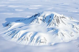
Numerous tide‑water glaciers terminate along the shores of British Channel, feeding icebergs into its waters. The most notable are:
| Glacier | Island | Notes |
|---|---|---|
| Glazunov Glacier | Rudolf Island (north of the channel) | Flows westward into the channel, calving annually. |
| Malyutka Glacier | Hooker Island | Small, steep glacier reaching the eastern bank of the channel. |
| De Bruyne Ice Front | Prince George Land | Feeds the De Bruyne Sound branch of the channel. |
Glacial melt contributes to seasonal variations in water depth and navigability.
Geology
The bedrock underlying British Channel consists chiefly of Precambrian gneisses and schists, overlaid in places by Devonian sandstones. The region has undergone multiple phases of uplift and erosion, with the most recent glaciations carving deep troughs and fjord‑like valleys that now host the channel.
Permafrost is continuous on the surrounding islands, and marine sediments in the channel record a long history of Arctic climate fluctuations.
Wildlife
Despite its harsh environment, British Channel supports a range of Arctic fauna:
- Marine mammals: Ringed seals (Pusa hispida) and bearded seals (Erignathus barbatus) use the ice‑edge for haul‑outs; occasional polar bear (Ursus maritimus) tracks are recorded on the western banks.
- Birds: Thick‑billed murre (Uria lomvia) and snow bunting (Plectrophenax nivalis) breed on the cliffs of Prince George Land and Hooker Island.
- Fish: Arctic cod (Boreogadus saida) and polar cod (Arctogadus glacialis) populate the cold, nutrient‑rich waters.
Seasonal ice cover influences predator‑prey dynamics, with peak seal pupping occurring in late spring when ice begins to retreat.
Exploration History
The channel was first reported by the British‑American Jackson–Harmsworth Arctic Expedition (1894–1897). In 1875, the expedition charted the western reaches of Franz Josef Land and named the waterway “British Channel” to honour the expedition’s sponsors from the United Kingdom.
Subsequent Russian surveys in the early 20th century refined its position and depth measurements, incorporating the channel into Soviet nautical charts used for Arctic navigation.
Historic Sites
Remnants of early exploration are sparse but include:
- Ruined stone cairns erected by the Jackson–Harmsworth party on the western shore of Prince George Land.
- Abandoned sled‑dog pens on Hooker Island, documented in Soviet aerial photographs from the 1950s.
These sites are protected under Russian heritage regulations.
Scientific Research
British Channel has been a focal point for multidisciplinary Arctic studies:
- Oceanography: Seasonal measurements of temperature, salinity and currents help model the inflow of Atlantic water into the Arctic Ocean.
- Glaciology: Time‑lapse satellite imagery tracks glacier calving rates and contributes to sea‑level rise estimates.
- Biology: Long‑term monitoring of seal populations provides indicators of ecosystem health.
Research stations on nearby Rudolf Island and Prince George Land periodically deploy autonomous underwater vehicles (AUVs) within the channel.
Name Origin
The name “British Channel” reflects the nationality of the expedition that first charted the strait. The Jackson–Harmsworth expedition, financed by British newspaper magnate Alfred Harmsworth, aimed to locate the elusive “Northeast Passage” and to claim new Arctic territory for scientific purposes.
Related Islands
Key islands bordering British Channel include:
- Prince George Land – the largest island on the western side of the channel.
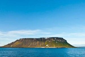
- Hooker Island – a rugged island to the east, named after British botanist Sir Joseph Hooker.
- Koetlitz Island – a smaller island east of Hooker, named after German polar explorer Karl Koetlitz.
- Rudolf Island – the northernmost island of the archipelago, lying just beyond the channel’s mouth.
FAQ
How deep is British Channel compared to other Arctic straits?
With an average depth of 522 m, British Channel is deeper than many nearby passages such as the Barents Sea’s narrow channels, but shallower than the deep basins of the Greenland Sea.
Can ships navigate through British Channel year‑round?
Navigation is limited to the brief Arctic summer when sea ice retreats. Even then, heavy ice conditions and iceberg presence require ice‑breaker assistance.
What wildlife is most commonly observed in the channel?
Ringed and bearded seals are the most frequent marine mammals; polar bears occasionally hunt along the ice edge, and seabirds such as thick‑billed murre breed on the surrounding cliffs.


Leave a Reply